Google Maps is introducing a significant wave of updates designed to enhance navigation, safety, and convenience for users across India, from daily commuters to long-haul drivers. These new features integrate advanced conversational AI, leverage official local data, and cater specifically to the complexities of Indian roads and public transport.
Smarter, Hands-Free Navigation with Gemini AI
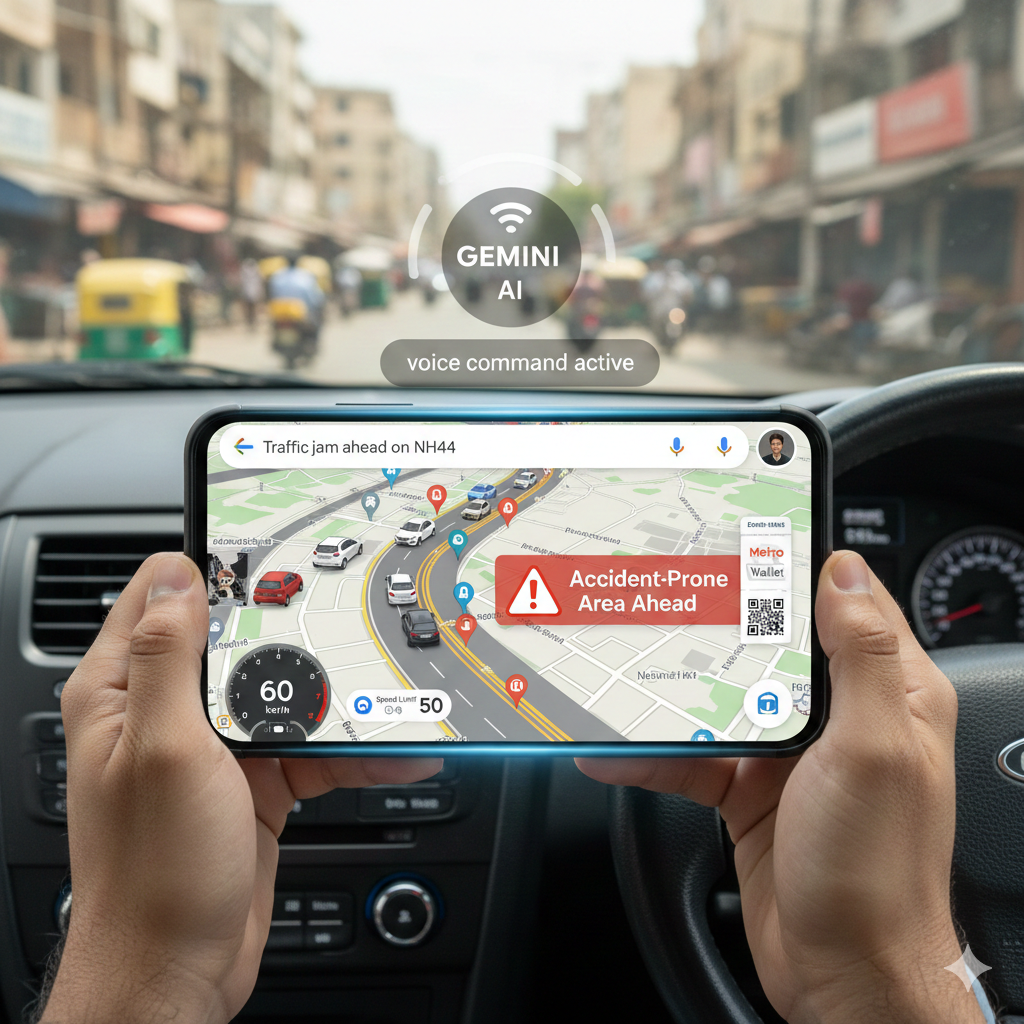
A core update is the integration of Gemini conversational AI directly into the Maps interface. This allows for a truly hands-free experience while driving or riding. Users can now utilize voice commands to ask complex questions—such as “Where is the closest petrol station?” or “What are the parking conditions at my destination?”—without needing to type or tap the screen. Furthermore, the AI can interact with other Google applications, letting users add calendar reminders or manage schedules while receiving navigation guidance.
The AI draws upon Google Maps’ vast database, using reviews and web content to offer helpful, context-aware tips about a location before arrival, making it easier to plan a visit.
Enhanced Safety and Real-Time Alerts
Several new tools are focused on improving road safety and providing critical real-time information:
- Accident-Prone Area Alerts: Developed in collaboration with local traffic authorities, this India-specific feature provides timely visual and voice warnings as drivers approach identified high-risk locations. This initiative is initially rolling out in cities including Gurugram, Chandigarh, Cyberabad, and Faridabad.
- Authoritative Speed Limits: The app will now display official speed limits during navigation, utilizing verified data from local traffic bodies. This information appears alongside the in-app speedometer and is being launched in nine Indian cities, including Mumbai, Hyderabad, and Kolkata.
- Proactive Traffic Warnings: A new alert system will notify users about traffic jams, road closures, and major disruptions ahead, even if the user isn’t actively navigating. This feature, which is starting its rollout in Mumbai, Delhi, and Bangalore, helps commuters stay informed about road conditions on major routes and highways.
Improved Highway and Public Transport Tools
Google is also partnering with national agencies to provide more reliable information for major travel:
- Official Highway Information: Through a collaboration with the National Highways Authority of India (NHAI), Google Maps will offer near real-time, official data on highway conditions, including road work, closures, and repairs. This partnership will also surface important details about wayside amenities, such as public restrooms, dining options, and petrol pumps.
- Flyover Voice Guidance: To assist two-wheeler and car drivers on complex routes, the app is introducing voice navigation specifically for flyovers in nine different Indian languages, ensuring clearer hands-free instructions for elevated sections of the road network.
- Integrated Metro Ticketing: For Android users, managing public transit tickets is now simpler. Purchased tickets can be saved directly to Google Wallet, allowing seamless access and integration within the Maps experience in metropolitan areas like Delhi, Chennai, Bangalore, and Kochi.